August 2008
July 2008 August October 2008
S M T W T F S
1 2
3 4 5 6 7 8 9
10 11 12 13 14 15 16
17 18 19 20 21 22 23
24 25 26 27 28 29 30
31
View entire year's route With Google Earth 223K
View year's Camps With Google Earth 33K
View this month's route With Google Earth 64K
Friday, August 1 Todays route using Google Earth
Camp-On-The-Heart Dickinson, North Dakota   Locate this campground with Google Earth $16.00 per night
Today we continued eastward on US 12   through a lot of beautiful territory including crossing the famous Power River locate with Google Earth. Much of the day was spent traversing more cowboy country and then we stopped for lunch at Bowman North Dakota. Stopping around us were several long horse trailers with real cowboys complete with dusty spurs, they have to eat too. Or as Charles Russel once said, a little girl asked her mom "Do cowboys eat grass?" to which her mother replied, "No, they're part human." At Bowman we turned northward onto US 85 and headed to Dickinson. The northward part of our trek was through areas that were raising grain and there were fewer cattle present. In the late afternoon we had the pleasure of watching a most unusual weather event of a beautiful set of clouds. In this photo group you can see the clouds along with a Google Earth overlay of the storm and an enhanced satellite image.  The storm covered about 1/3 of the state of North Dakota and we could see almost all of the cloud formation in excess of 200 miles across.

Saturday, August 2 A visit to Theodore Roosevelt National Park Locate this campground with Google Earth W was the outing for today. This park protects several natural areas in honor of our first conservationalist President. The park has north and south units which encompass areas near where Roosevelt had stakes in several ranches in the late 1800's.   It was hot and dry today so we didn't do any hiking. Besides some beautiful scenery we saw lots of prairie dogs but none of the park's wild horses or buffalo. The park also contains the original cabin built by Roosevelt. We stopped by a local RV repair shop and got a replacement handle for one of the gray water tank drains which stripped its threads and came off a few days ago.

Sunday, August 3 Todays route using Google Earth
Roughrider Campground, Minot, North Dakoda   Locate this campground with Google Earth $23.00 per night See Good Sam discount info on help page
Today's trip took us primarily north. We crossed some more eroded landscape  around the Little Missouri River where we also crossed into Central Time. We pulled off the road to look at an historic marker which remembers "The Lost Bridge". Here is the story from the marker.
The Lost Bridge Locate with Google Earth locate with Google Maps  

Lost Bridge spanned the Little Missouri River about 500 yards northeast of this point. The bridge symbolized many aspects of our cultural, social, and economic heritage. Large cattle ranches dominated the area in the late 1800's and those that survived the rigorous winters prospered. The route on which the bridge existed was a cattle trail leading north to spring pastures. Cattle herds forded the Little Missouri River but were often stopped by high water. To gain access to the north side during high water required a long drive to the west across the Long X Bridge near Watford City, over 60 miles away. locate with Google Earth Since this route was not economical the idea of a bridge was born.

Political influence generated by successful cattle ranchers, coupled with the insistence of surrounding communities, led to the appropriation of state funds for the construction of a bridge. The bridge was built in 1931 at a cost of $73,677. But in 1930, Congress cut the funding for road construction projects on public lands by 50 percent. Since land north of the bridge is public land because it lies within the Fort Berthold Indian Reservation, the 50 percent reduction hindered the state's ability to immediately construct roads. But the road had a low priority even without the federal cutback. An ungraded primitive two track trail led to and from the bridge for the next 22 years. Thus the structure became known as "Lost Bridge".

The original bridge was dissembled after a new bridge was built in 1991. A portion of the old bridge serves as the mount for this historical marker. As an interesting connective point, this historical marker refers to the "famous Long X bridge". One of the brands on an historical marker we saw on July 30 (see lower left photo about half way down the center column) shows the Long X brand. Also one of my favorite songs by The Sons Of The San Joaquin is called The Famous Long X brand. The one the song refers to was in Texas but there must have been a connection as many major brands were to be found in many states. (listen)

Monday, August 4 Not much to report today. We did some shopping and prepared rodeo contestant mail out packets. Oh, we found a fantastic home center called Menards. Frank was very impressed. They had electrical parts we can't even order back east. Home Depo should look at these people and follow their example, then maybe they would avoid going out of busness as Frank thinks they will in a few years. The bulk of the Menards stores seems to be centered around Chicago.

Tuesday, August 5 Todays route using Google Earth
Spirit Lake Casino & Resort, Devils Lake, North Dakota   Locate this campground with Google Earth $22.00 per night
We moved further east today by about 150 miles. This is another casino campground. While the facilities are nice, there is no Internet connection here in the campground and our cell service is very slow. The region we are crossing now is very flat farmland.  The ice age glaciers scraped this area clean leaving various depressions everywhere. These depressions form lakes and ponds. We are on the edge of Devils Lake which is one of the largest lakes in the area. Many of these lakes and ponds have no outlet so water accumulates and can only escape by evaporation. Devils Lake has been rising over the last couple of decades as can be seen by many dead waterlogged trees along the shallow areas.   One interesting place we passed today was Rugby, North Dakota locate with Google Earth which is the geographic center of North America. Geographic centers are determined by an averaging of all the land masses that make up the region being considered and finding a mathematical center.
Wednesday, August 6 Todays route using Google Earth
Stony Point Resort, Cass Lake, Minnesota   Locate this campground with Google Earth $30.89 per night
As we move further east we are seeing distinct changes in the trees.   Five days ago we were in areas of grassy fields and rugged terrain, now we are in areas of northern pines and spruce trees. We are also experiencing a 10 fold increase in the number of cars on the highway. And lest not forget, billboards. We stoped for lunch along the route at a Minnesota rest area. locate with Google Earth   This campground is on a large lake and the afternoon breezes today are very pleasant. The campground is mostly permanents and seasonal's but the overnight area is not bad at all.
Thursday, August 7 Todays route using Google Earth
Ogstons RV Park, Saginaw, MN   Google Earth $29.00 per night
As we head further east, the trees are continuing to change. We are now in the areas of the great northern forests.   Shortly after starting today, we crossed the Mississippi river, just 10 miles from its source. Locate this campground with Google Earth At this point the mighty river is about 20 feet across. We went through Grand Rapids Minnesota and had to detour around some construction. Tonight we are camped about 10 miles from Duluth and it is supposed to get down to about 49 degrees. Frank has the windows open and the fan going. While the humidity is higher than it was way out west, the air is clean and wonderful to breathe. This campground has no lights and for the first time we can see the stars in multitudes. Around 10:30 in the evening, Frank put the camera on a tripod and played with some long exposure shots.   Had dinner at a local restaurant and it was delicious.

Friday, August 8 Not much to report today except we bought a new vacuum for the trailer. An Oreck Ironman which is much better than what we had before. We did drive through the city of Duluth, found it crowded with cars and people.   Nice town but too cluttered for us after having spent the last few weeks in the wide open spaces of the west. The Internet connection at this campground which was great the first evening has become very slow and sluggish.

Saturday, August 9 Again not much to report. Frank worked on web pages, Tom did laundry. We got a lot of small things done around the trailer that have been backing up. Tomorrow we move on.

Sunday, August 10 Todays route using Google Earth
A rather heavy driving day at 255 miles. We passed several areas where Lake Superior was visible from the road looking like a large sea. The air today was beautifully clean and clear with scattered white puffy clouds. The temperature only got up to about 70 so this was a great day to drive. Webcam Shots   This campground is very pleasant with wide sites. The owners very friendly. The Wi-Fi access in a bit limited, being available only near the office. However, with our "gear", we were able to connect from our site. En route we stopped at a small rest area to switch drivers and came across an interesting sign about a small river next to the rest area. Following is the sign's text.
The Brule River   locate with Google Earth W

The Brule River flows in the former channel of a larger river which once flowed in the opposite direction and drained melting ice from glacial Lake Duluth. The receding glacier created Lake Superior and also carved the valley now occupied by the Brule. Instead of flowing southward our of Lake Superior, the Brule now flows northward into it.

The source of the name is the Ojibwa name for the river, "Wisakota", meaning burned or burnt, which the French Voyaguers translated as Brulé.

A short portage at Upper St. Croix Lake connects the Brule and St. Croix river systems. This route became known to French explorers in 1680 and became so important in the early fur-trade that France built forts at each end of it for protection. The French lost their North American colony to England in 1763

Not far from here on October 1, 1842, a Sioux war party led by Old Crow penetrated this territory intent on seeking out small bands of Chippewa. Chief Buffalo of the Chequamegon Bay Chippewa quickly gathered 200 braves to meet the much larger Sioux force. The enemies met at sunset on opposite banks of the Brule. When the Sioux attacked the next morning, two groups sent by Buffalo above and below the Sioux attacked them from the rear. The Sioux suffered a bloody defeat and never again entered this territory.

Monday, August 11 Todays route using Google Earth
Mackinaw Mill Creek Camping, Mackinaw City, Michigan   Locate this campground with Google Earth $40.00 per night
We drove along the north coast of Lake Michigan   today stopping at a rest area for lunch.   This beautiful rest area, picnic ground and swimming beach is maintained by the Michigan highway department. The site was so beautiful and neatly kept, one would have believed it was a state park. I thik other highway departments could learn from Michigan. A little further along we pulled into another highway department overlook to view the famous Mackinac bridge. locate with Google Earth Webcam image    The overlook also had an historic sign about US highway 2 which we have been following for a number of days. One side of the sign was in English, the other in Anishinabe, a local Native American language. Part of the text is included below in the box. We crossed the bridge and followed through to our campsite. This campground is very large with over 1000 sites but with well spaced sites, well managed and very neat. Oh, and we crossed back into Eastern time early in the day.
Ancient Anishinabe Path locate with Google Earth W

The route that US 2 follows today has served as an important transportation corridor from the earliest inhabitants of the Michigan Peninsulas to the present.

When the Federal Highway System was established (1926-27) the second route designated a Federal Highway ran east-west across the Upper Peninsula of Michigan. The original route for the eastern portion of US 2 ran from Brevort east to Moran, then southeast to St. Ignace. The existing route was completed in 1938, and closely follows an ancient route used by Native Americans, explorers, soldiers and settlers.
Full text in english  


Gete Anishinaabek Miikaan

Enininamook noongo US 2 aapiji giji-naabijikaaziskaade dibishkoo gonaa mewzhi gaatami-yaajig gaazhi-nakaaziwad, Michigan Neyaashiing gaadaajig.

Mewzhi Federal Highway System gii-zhitjigaade 1926-27, eko-niishing dash miinwaa gii-zhitigaade Federal highway qii-mamowa waabinong-epingishimok nikeyaa, qii-takamoowa shpiming Michigan Neyaashiing. Wi dash wiigo ntam gaa-mamoowak waabanoong nikeyaa US 2 qii-ji-maajitaamoowa Brevort waabinong nikeyaa biinish Moran, mii-dash zhaawanoong-waabanoong St. Ignace. Megwa dash zhe eteq gchi-miikan 1938 qii-zhitigaadeban, gegaa gwa naasaap Anishinaabeg gaa-bi-daajig maanpii nikeyaa.

Tuesday, August 12 Todays route using Google Earth
Camp Cadillac, Cadillac, Michigan   Locate this campground with Google Earth $36.00 per night
A stop over en route south. An old KOA campground which is in need of a bit of cleaning, small bits of trash are scattered around the campsites. The included high speed Internet was so slow we switched to our own system which was faster even though it was slower than a dial up.
Wednesday, August 13 Todays route
Woodchip Campground, Byron Center, Michigan   Locate this campground with Google Earth $37.00 per night
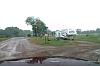
We are slowly moving toward Indiana to have some work done on the trailer. We stopped along the way at a rest area locate with Google Earth that was listed as scenic. I guess scenic is relative as the view was mostly the tops of trees and the sight distance was maybe a couple of miles. However, I am continually impressed with how Michigan handles their rest areas. They are always neat and well laid out. This one had an historical marker and a memorial plaque to an obviously well loved chief maintenance engineer.   This is a very nice campground, clean with lots of trees. And the Internet connection is the best we have had so far on the entire trip. The campground is very near Wyoming....... Wyoming, Michigan that is. Wyoming Michigan

Thursday, August 14 This morning we hooked the trailer up and took it to a nearby Camping World where they installed some deluxe covers on our ceiling fan vents. Now we can leave the fans on during rain and don't have to worry about getting rain into the trailer. We also got new water hoses and a new dish strainer to replace our old one which we have been using since 1988. The new one is exactly like the old one, except less faded. It is a good design and it's nice to see something which works well not fiddled with just to make it new. Sometime during the day Frank's electric blanket controller shorted out blowing a breaker and our main light control module, so our 2 dimable lights are non-dims (a theatrical term) until we can get replacement controllers. After returning the trailer to our site, we went shopping. We went to another Mainerd's and got some new rubber matting for the back of the truck along with some hose connectors. This evening we were blessed with a beautiful sunset.  

Friday, August 15 Todays route using Google Earth
Sunny Brook RV Resort, South Haven, Michigan   Locate this campground with Google Earth $45.00 per night
This is a brand new condo RV park and at this point is very pretty although the trees still need to do some growing. Wi-Fi works well and is included in the cost. Today's ride was relatively short at 65 miles and the weather was great.   We just missed the campground and had to turn around using some dirt roads. The landscape in this region is generally flat with sandy soil. The trees are not much different than what we have at home in Virginia. Traffic is increasing.

Saturday, August 16 We drove down to the local town of South Haven and found it to be very touristy with lots of gift shops. It was very difficult to find a place to park. Tom thoroughly washed the truck and the front of the trailer. The truck now looks like a brand new vehicle. Frank has developed a skin allergy of some sort with major rashes on his legs and stomach.   We are scratching our heads trying to figure what is causing it, and Frank is scratching his legs from the rash. Our latest idea is it may be the laundry detergent, so Tom is washing some of Frank's clothes with no soap to see if that helps clear the condition. This evening we went to a pig roast here in the campground put on by the hosting company. Bar-B-Que was pretty good but the company was not very friendly. Just about every family stayed separate and there was very little mingling. As the evening approached, Frank climbed on top of the trailer and scrubbed the roof areas of the slide-outs. Tomorrow we move on to Indiana.

Sunday, August 17 Todays route Locate using Google Maps
Pla-Mor Campground, Bremen, Indiana   Locate with Google Earth $32.10 per night
We are now positioned in Indiana about 20 miles from our RV's manufacturer. Tomorrow we get up early for the short trip and a 9:00 am appointment. This is a fairly nice campground but big with over 600 sites but only about 100 occupied. Frank got another horse trail ride today   at a nice little dude ranch called Marshland Trail Riding Farm Todays route , run by a great lady named Kelly. They are just getting started in this business and we hope they do well. They had a mounting platform which Frank was glad to have, but he felt a bit like a green horn, no real cowboy would need a mounting platform. But then again, Cowboy Frank's knees aren't what they use to be. This time Frank's horse was named Sadie rather than Grumpy. Sadie was a good horse, with a touch of draft in her, so she was laid back and docile.

Monday August 18 Our route using Google Earth Our route using Google Maps Early this morning we packed up and headed toward Syracuse to take the trailer to Ameri-Camp locate with Google Earth for some service. We hit some unexpected road construction and the detour began taking us completely in the wrong direction to get where we needed to go. Luckily we had GPS maps so we were able to re-route our detour through back roads which, as we learned the next day, saved us about 10 miles. After dropping off the trailer and showing Charlie and Mike what needed doing, we left and got a room at the Oakwood Inn. locate with Google Earth That's when we learned the Oakwood Inn will be closing next week so we got in just in time.  Frank and his Sister Sallie stayed here last year when they brought the trailer up from Clifton for work. I'm going to count this as being the same group because when we got the trailer back on Tuesday afternoon we took it back to the same campground and site we were on yesterday.

Tuesday, August 19 We didn't expect to get the trailer back until late afternoon so we looked for something to do. In the nearby town of Elkhart is the RV-MH hall of fame and museum locate with Google Earth, which contains a great exhibit of travel trailers and motor homes from the past and present. The current museum building is very new so, as of this posting, Google Earth only shows an empty field. For the moment I am including photos of the signs for information on each display. At some point I may translate these signs into text for easier reading. Note that this is a large gallery currently with 85 images so it is its own page rather than a popup gallery. After an interesting afternoon at the museum, we picked up the trailer and took it back to Pla-Mor campground onto the same site we had on the 17th.

Wednesday, August 20 Today was another day of work in the trailer. This time mostly paperwork consisting of rodeo issues and website items. Tomorrow we head toward Chicago and the rodeo (linked below). We will be positioning the trailer in the parking lot of the rodeo's host hotel and staying in the hotel until next Monday. Therefore, this will be the last entry until next Monday or Tuesday evening. Friday, Frank will be attending the IGRA board meeting where he will webcast the meeting. Saturday and Sunday we will be enjoying the rodeo. Watch for rodeo photos to be posted on the gallery page either Saturday or Sunday evening.

August 21-24 Todays route using Google Earth
Double Tree Hotel   Alsip, IL Locate this campground with Google Earth $0.00 per night
The next four nights were spent at the host hotel for the Chicago Rodeo so there are no entrees while we attended the rodeo and board meetings. They allowed us to park the trailer in the corner of their parking lot so that made everything easy.
Monday, August 25 Locate with Google Earth
Clay's Park Resort, North Lawrence, OH. Google Earth $39.80 per night
A VERY long drive of 384 miles today. We are back in the same campground as earlier in the trip but in a different site. We drove all the way from Chicago to Canton, Ohio today. This is the longest distance we have driven with the trailer. We got to Clay's Park about 7:30 PM, set up camp, and headed straight to Swenson's for their delicious hamburgers.

Tuesday, August 26
Tom had arranged for Pat and himself to visit their brother-in-law, Dave, who at age 84 was dying of cancer. The visit went extremely well, and Dave seemed in great spirits. Frank stayed with Lee (Tom's nephew) and they had lunch at Swenson's. In the meantime Pat and Tom had lunch at Bob Evans near where Dave lives. Frank bought Pat a new computer and installed it while Pat and Tom were gone. For dinner that night…yep you guessed it…Swenson's again.

Wednesday, August 27
Frank and Tom again went to visit Pat and Lee and said their goodbyes. We returned to the trailer to clean up and get ready the next day for the trip home.

Thursday, August 28 Todays route using Google Earth
Sand Springs Campground   Morgantown, WV Locate this campground with Google Earth $32.94 per night
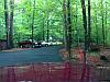
Was raining some today. This is a fairly nice campground, way back in the woods and is very quiet and plesent except for the wetness.
Friday, August 29 Todays route using Google Earth
Home   Clifton, VA Locate this campground with Google Earth $0.00 per night
We are home. This has been a fantistic trip but we pushed a bit too much near the end.